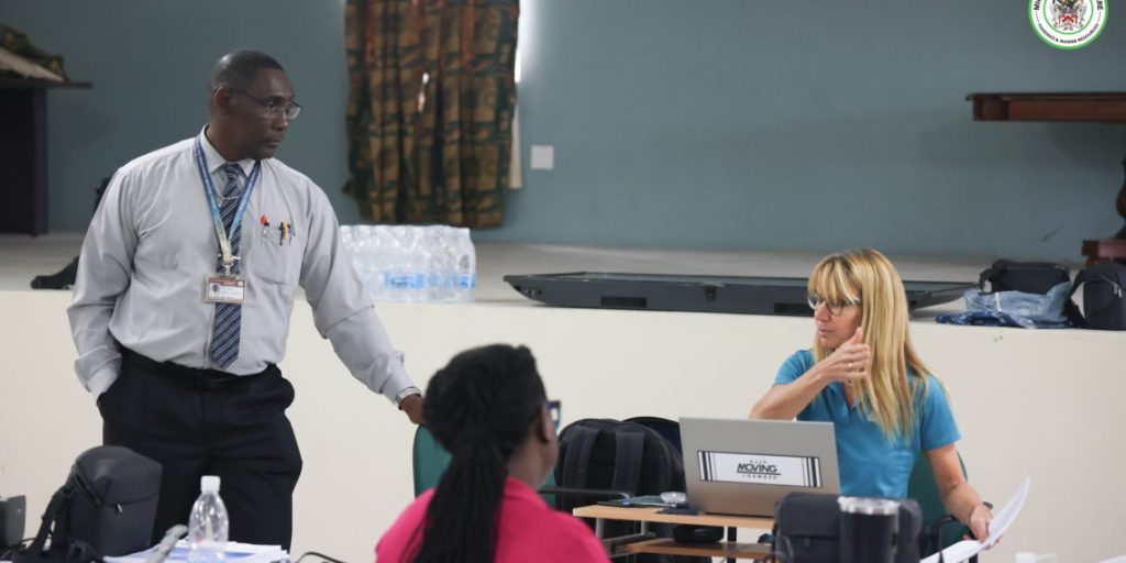
Regional Training on Drone Mapping and Geospatial Analysis for Agricultural Enhancement in St. Kitts and Nevis, Conducted by the Department of Agriculture (DOA) and the Food and Agriculture Organization (FAO)
Enhancing Caribbean Agriculture Through Digital Innovation: A Deep Dive into Drone Mapping and Geospatial Analysis Training in St. Kitts and Nevis
The agricultural landscape in the Caribbean is undergoing a transformative shift, driven by the integration of digital technologies. A prime example of this evolution is the recent regional e-agriculture training workshop focused on drone mapping and geospatial analysis, held in St. Kitts and Nevis. Co-organized by the Department of Agriculture (DOA) in St. Kitts and Nevis and the Food and Agriculture Organization of the United Nations (FAO), this initiative underscores the growing recognition of the crucial role digital innovation plays in modernizing agricultural practices and boosting productivity, especially within the unique context of Small Island Developing States (SIDS). The training aimed to empower agricultural stakeholders with the skills and knowledge necessary to leverage these cutting-edge technologies for improved farm management, resource allocation, and disaster risk reduction.
The training program, strategically held at the Department of Agriculture’s conference room in St. Kitts, brought together a diverse group of participants from across the Caribbean region. This included representatives from Antigua and Barbuda, Dominica, Grenada, St. Kitts and Nevis, Saint Lucia, and St. Vincent and the Grenadines. The diversity of participants facilitated the sharing of unique perspectives and regional challenges, fostering a collaborative environment for learning and knowledge exchange. This regional approach is essential for building a network of experts who can collectively advance the adoption of digital agriculture technologies and share best practices. The workshop provided a platform for participants to delve into the practical applications of drone technology and geospatial analysis within the agricultural context.
The curriculum encompassed a comprehensive range of topics, from the fundamentals of drone operation and data acquisition to advanced geospatial analysis techniques. Participants gained hands-on experience in operating drones, capturing high-resolution imagery, and processing the acquired data to generate valuable insights. The training emphasized the use of open-source software and tools, ensuring accessibility and sustainability for the participating nations. Key areas of focus included utilizing drone-captured data for crop monitoring, assessing soil health and nutrient levels, optimizing irrigation systems, and creating precise farm maps. Furthermore, the training explored the application of these technologies for disaster risk management, allowing for rapid assessment of damage and informed decision-making in the aftermath of natural disasters, a critical concern for SIDS.
The integration of drone technology and geospatial analysis holds immense potential for transforming agricultural practices in the Caribbean. These technologies offer unprecedented opportunities for precision agriculture, enabling farmers to make data-driven decisions that optimize resource utilization, enhance crop yields, and minimize environmental impact. By providing real-time, high-resolution data on crop health, soil conditions, and other critical factors, these tools empower farmers to implement targeted interventions, reducing input costs and maximizing output. This data-driven approach is particularly relevant for SIDS, which often face challenges related to limited arable land, water scarcity, and the vulnerability to climate change impacts.
Beyond the immediate benefits for individual farmers, the adoption of digital agriculture technologies has broader implications for regional food security and economic development. By improving agricultural productivity and efficiency, these technologies can contribute to increased food production, reduced reliance on imports, and enhanced competitiveness in regional and international markets. Furthermore, the growth of the digital agriculture sector creates new opportunities for innovation, entrepreneurship, and skilled employment, contributing to the diversification and resilience of Caribbean economies. The regional nature of the training program further strengthens these benefits by fostering collaboration and knowledge sharing among participating countries, creating a network of expertise and support for the advancement of digital agriculture.
The FAO plays a pivotal role in supporting the development and implementation of digital agriculture initiatives in the Caribbean and globally. Through its technical expertise, capacity building programs, and knowledge sharing platforms, the FAO empowers countries to harness the transformative potential of digital technologies for sustainable agricultural development. The collaboration between the FAO and the DOA in St. Kitts and Nevis exemplifies this commitment to driving innovation and promoting evidence-based solutions for the challenges facing agriculture in SIDS. The training program represents a significant step towards building a more resilient and sustainable agricultural sector in the Caribbean, equipped to address the evolving demands of a changing climate and globalized food system. The continued investment in and adoption of digital technologies will be crucial for unlocking the full potential of Caribbean agriculture and ensuring food security and economic prosperity for the region.
Share this content:


Post Comment